A Civilizational History of Space, Power, Resources, Connectivity and Human Survival
Strategic Geography is the study of how physical space influences the rise, survival, prosperity, and decline of civilizations, states, empires, institutions, and global systems. Unlike descriptive geography, strategic geography examines terrain as an active determinant of political behaviour, military planning, economic connectivity, technological innovation, intelligence operations, demographic patterns, and civilizational resilience.
Throughout history, mountains have protected civilizations, rivers have sustained agriculture and trade, deserts have acted as barriers, seas have connected continents, and chokepoints have determined the fate of empires. Geography has influenced the location of capitals, the emergence of religions, migration routes, imperial expansion, colonial networks, industrialization, and the distribution of natural resources. In the modern era, strategic geography extends beyond land and sea to include airspace, cyberspace, undersea infrastructure, orbital domains, and the Arctic and Antarctic frontiers.
This encyclopedia presents strategic geography as the enduring spatial framework within which civilizations compete, cooperate, and evolve. It integrates classical geopolitical thought with contemporary developments in geoeconomics, intelligence, environmental security, critical infrastructure, and emerging domains of strategic competition. We shall cover the following areas, which would explain how geography influences:
- Civilization
- Intelligence
- The Vedic Nation
- Political power
- Military strategy
- Maritime dominance
- Economic development
- Intelligence Operations and Global Covert Operations
- Technological evolution
- National security
- Environmental sustainability
- Space expansion
Meta-Architecture
Strategic Geography can be understood as ten interacting systems:
- Physical Geography
- Human Geography
- Resource Geography
- Maritime Geography
- Military Geography
- Political Geography
- Economic Geography
- Intelligence Geography
- Technological Geography
- Space Geography
______________________
Geography, from ancient cartography up to 2026
Volume 1: History of Geographic Thought
1. Ancient & Classical Geography (Before 500 CE)
- Babylonian world map (c. 600 BCE) – Clay tablet, world as disc surrounded by ocean
- Ancient Egyptian geography – Nile as axis, expeditions to Punt
- Greek pioneers – Anaximander (first world map), Hecataeus (Ges Periodos), Herodotus (History – descriptions of lands, critique of circular ocean)
- Eratosthenes (c. 276–194 BCE) – Coined “geography” (geographica), calculated Earth’s circumference (within 10%), first map with parallels and meridians
- Hipparchus – Introduced grid system (latitude/longitude), stereographic projection
- Strabo – Geographica (17 volumes), regional descriptions, historical geography
- Ptolemy – Geographia (c. 150 CE), world atlas using latitude/longitude, conical projection, errors (overestimated Asia) used by Columbus
2. Medieval Geography (500 – 1400 CE)
- Islamic Golden Age – Al‑Idrisi (Tabula Rogeriana, 1154, most accurate medieval world map), Ibn Battuta (travels 75,000 miles, Rihla), Al‑Biruni (determined Earth’s radius, India described), Ibn Khaldun (Muqaddimah – environmental determinism)
- Chinese geography – Pei Xiu (cartographic grid system, 3rd century), Zheng He’s naval expeditions (15th century, reached Africa)
- European T‑O maps – Jerusalem at center, three continents (Asia, Europe, Africa) separated by Mediterranean, Nile, Don rivers
- Mappa mundi – Hereford Mappa Mundi (c. 1300), theological geography
3. Age of Discovery & Renaissance (1400 – 1700)
- Portuguese discoveries – Prince Henry the Navigator, Dias (Cape of Good Hope), da Gama (India)
- Columbus – Caribbean landfall (1492), still believed reached Asia
- Amerigo Vespucci – Recognized Americas as new continent (1501–1502), “America” named after him
- Magellan‑Elcano expedition (1519–1522) – First circumnavigation of Earth
- Mercator projection (1569) – Gerardus Mercator, conformal, straight rhumb lines (navigation), massive area distortion at poles
- Ortelius – Theatrum Orbis Terrarum (1570), first modern atlas
- William Camden – Britannia (1586), chorography (regional description)
- Bernhard Varenius – Geographia Generalis (1650), divided geography into general (systematic) and special (regional)
4. Modern Geography Emerges (1700 – 1900)
- Immanuel Kant – Geography lectures at Königsberg, geography as spatial synthesis, chorological approach
- Alexander von Humboldt – Kosmos (1845–1862), plant geography, isotherms, vertical zonation, holistic nature study
- Carl Ritter – Erdkunde (1817–1859), comparative regional geography, teleological view
- Charles Darwin – Voyage of the Beagle, biogeography (Galapagos finches, coral atoll formation theory)
- Alfred Russel Wallace – Wallace Line (faunal boundary between Asia and Australia), biogeography
- George Perkins Marsh – Man and Nature (1864), early conservation, human impact on environment
- Friedrich Ratzel – Anthropogeographie (1882–1891), environmental determinism, concept of Lebensraum (living space)
- Paul Vidal de la Blache – Possibilism (human agency within environmental limits), Tableau de la Géographie de la France (1903)
- Halford Mackinder – Heartland Theory (1904, geopolitical), “Who rules East Europe commands the Heartland…”
5. 20th Century to 2026: Disciplinary Evolution
- Regional geography – Dominant early 20th century (Hartshorne, The Nature of Geography, 1939)
- Quantitative revolution (1950s–1960s) – Spatial analysis, statistical methods, models (gravity model, central place theory), William Garrison, Walter Isard (regional science), Brian Berry
- Critical geography (1970s onward) – Marxist (David Harvey), feminist, postcolonial, radical geography
- Behavioral geography – Perception, decision‑making (mental maps, Kevin Lynch)
- Humanistic geography – Place, meaning, experience (Yi‑Fu Tuan, Edward Relph, Anne Buttimer)
- GIS revolution (1980s–2026) – Geographic Information Systems, spatial databases, digital cartography
- Remote sensing (1970s–2026) – Landsat (1972), SPOT, Sentinel, high‑resolution commercial (Maxar, Planet)
- Big data & geospatial AI (2010s–2026) – GPS traces, social media geotags, machine learning for land cover classification, location intelligence
Volume 2: Physical Geography
6. Geomorphology (Landforms & Processes)
- Plate tectonics – Continental drift (Wegener, 1912), seafloor spreading (Hess, 1960), plate boundaries (divergent, convergent, transform), earthquakes, volcanoes
- Weathering & erosion – Mechanical (frost wedging, salt crystal growth), chemical (hydrolysis, oxidation, carbonation), biological
- Fluvial processes – Rivers: meandering, braided, anastomosing; erosion, transport, deposition; drainage basins, stream orders (Strahler), floodplains, terraces
- Glacial geomorphology – Alpine glaciers (cirques, aretes, horns, U‑shaped valleys), continental ice sheets (drumlins, eskers, moraines, till), glacial isostatic rebound
- Coastal geomorphology – Waves, tides, longshore drift; erosional features (cliffs, sea stacks, wave‑cut platforms); depositional features (beaches, spits, barrier islands, deltas)
- Aeolian processes – Wind erosion (deflation, abrasion), sand dunes (barchan, linear, star), loess deposits
- Karst topography – Limestone dissolution, sinkholes, caves, stalactites/stalagmites, poljes
- Tectonic geomorphology – Fault scarps, mountain building (orogeny), uplift rates, paleoseismology
7. Climatology & Meteorology
- Climate system – Atmosphere, hydrosphere, cryosphere, lithosphere, biosphere interactions
- Solar radiation – Insolation, albedo, greenhouse effect, radiative forcing
- Atmospheric circulation – Hadley cell, Ferrel cell, Polar cell, jet streams, trade winds, westerlies
- Ocean circulation – Thermohaline circulation (global conveyor belt), El Niño‑Southern Oscillation (ENSO), North Atlantic Oscillation (NAO), Pacific Decadal Oscillation (PDO)
- Köppen climate classification – Groups A (tropical), B (dry), C (temperate), D (continental), E (polar), plus subcategories (Af, Aw, BSh, Cfb, Dfc, EF, etc.)
- Weather systems – Air masses (cP, mT, etc.), fronts (cold, warm, occluded, stationary), cyclones (mid‑latitude, tropical), anticyclones
- Extreme weather – Hurricanes/typhoons/cyclones (Saffir‑Simpson scale), tornadoes (Fujita/Enhanced Fujita), thunderstorms, blizzards, heatwaves, droughts
- Climate change – Global warming (IPCC reports 1990–2026), greenhouse gases (CO₂, CH₄, N₂O, F‑gases), sea level rise, permafrost thaw, ocean acidification, climate feedbacks
8. Biogeography
- Biomes – Tropical rainforest, tropical savanna, desert, Mediterranean (chaparral), temperate forest (deciduous, coniferous), temperate grassland (prairie, steppe), tundra, taiga (boreal forest), polar ice caps
- Ecosystems – Energy flow (food web), nutrient cycling (carbon, nitrogen, phosphorus), primary productivity (GPP, NPP)
- Biodiversity patterns – Latitudinal diversity gradient (species richness highest at equator), island biogeography (MacArthur & Wilson, equilibrium theory)
- Phytogeography – Plant distribution, endemism, relicts, floristic kingdoms (Holarctic, Neotropical, etc.)
- Zoogeography – Faunal regions (Wallace’s 6 realms: Nearctic, Neotropical, Palaearctic, Ethiopian, Oriental, Australian)
- Invasive species – Pathways, impacts, control, global homogenization
9. Soil Science (Pedology)
- Soil formation factors – CLORPT (Climate, Organisms, Relief, Parent material, Time)
- Soil horizons – O (organic), A (topsoil), E (eluviation), B (illuviation), C (parent material), R (bedrock)
- Soil classification – USDA Soil Taxonomy (12 orders: Entisols, Inceptisols, Alfisols, Mollisols, Aridisols, Spodosols, Ultisols, Oxisols, Vertisols, Andisols, Gelisols, Histosols); FAO World Reference Base (WRB)
- Soil properties – Texture (sand, silt, clay), structure, pH (acidic, neutral, alkaline), cation exchange capacity (CEC), organic matter, salinity, sodicity
- Soil degradation – Erosion (water, wind), desertification, salinization, acidification, compaction, contamination
10. Hydrology & Water Resources
- Hydrologic cycle – Evaporation, transpiration, condensation, precipitation, infiltration, runoff, groundwater flow
- Surface water – Rivers, lakes, wetlands; hydrograph (storm response), water balance (P = Q + ET + ΔS)
- Groundwater – Aquifers (unconfined, confined, artesian), water table, recharge, discharge, Darcy’s law, cones of depression, contamination (nitrates, VOCs)
- Watershed (catchment) management – Hydrologic unit codes (HUC), non‑point source pollution, stream restoration
- Water scarcity – Physical vs. economic scarcity, groundwater depletion (Ogallala, North China Plain), water stress indices, desalination, water reuse
Volume 3: Human Geography
11. Population Geography
- Demography – Fertility (CBR, TFR), mortality (CDR, IMR, life expectancy), migration (push‑pull factors, net migration)
- Population growth – Malthusian theory (1798), demographic transition model (Stage 1–5), population momentum
- Population distribution & density – Arithmetic density, physiological density, agricultural density, ecumene (inhabited lands)
- Population pyramids – Expanding (youthful), stationary (constrictive), contracting (aging)
- Migration types – Internal vs. international, forced (refugees, IDPs) vs. voluntary (economic, chain migration), step migration, counter‑urbanization
- Population policies – Pro‑natalist (Sweden, France, Japan) vs. anti‑natalist (China’s one‑child policy 1979–2015, two‑child 2016, three‑child 2021)
12. Cultural Geography
- Culture concepts – Culture trait, complex, region, realm; folk culture vs. popular culture
- Language geography – Language families (Indo‑European, Sino‑Tibetan, Niger‑Congo, etc.), dialect, isogloss, lingua franca, language shift, endangerment
- Religion geography – Universalizing (Christianity, Islam, Buddhism) vs. ethnic (Hinduism, Judaism, Shinto); sacred spaces, pilgrimages, religious diffusion
- Ethnicity & race – Ethnic enclaves, segregation (residential), ethnic conflict, nationalism
- Cultural landscapes – Carl Sauer (Berkeley School), built environment, vernacular regions, sense of place, placelessness
- Globalization – Cultural homogenization (McDonaldization), hybridization, glocalization, cultural imperialism
13. Economic Geography
- Economic sectors – Primary (extraction), secondary (manufacturing), tertiary (services), quaternary (knowledge/information), quinary (executive decision‑making)
- Location theory – Von Thünen (agricultural land use model, 1826), Weber’s least‑cost theory (industrial location), Losch’s central place theory (profit maximization)
- Industrial geography – Agglomeration economies, industrial districts (Silicon Valley, Third Italy), deindustrialization (Rust Belt), offshoring, global value chains (GVC)
- Agriculture geography – Agricultural revolutions (Neolithic, British, Green), von Thünen rings, subsistence vs. commercial agriculture, crop regions (wheat belt, corn belt), plantation agriculture, agribusiness
- Transport geography – Networks (graph theory, connectivity), hubs, intermodal transport, friction of distance, time‑space convergence
- Development geography – Measures (GDP, GNI, HDI, Gini coefficient), core‑periphery models (Wallerstein’s world‑systems theory, dependency theory), Rostow’s stages of growth, neoliberal development (IMF, World Bank), sustainable development (SDGs)
14. Urban Geography
- Urbanization – Urban population growth, suburbanization, exurbanization, re‑urbanization (gentrification), megacities (>10 million), metacities (>20 million)
- City structure models – Burgess (concentric zone), Hoyt (sector), Harris‑Ullman (multiple nuclei), Galactic city (edge cities, peripheral nodes)
- Central Place Theory (Christaller, 1933) – Hierarchy, threshold, range, hexagonal hinterlands
- Urban land use – Zoning, residential segregation (income, race), gated communities, slums (informal settlements, favelas, katchi abadis)
- Urban planning & design – Garden City movement (Howard), Le Corbusier (Radiant City), New Urbanism (transit‑oriented development, walkability)
- Urban problems – Traffic congestion, air pollution, heat island effect, housing affordability, homelessness, crime, gentrification displacement
- Smart cities (2020s–2026) – IoT sensors, data‑driven management, smart grids, e‑governance, privacy concerns
15. Political Geography
- State & nation – Nation‑state, multinational state, stateless nation (Kurds, Palestinians), failed states (Fragile States Index)
- Boundaries – Natural (rivers, mountains), geometric (lines of latitude/longitude, US‑Canada border), antecedent, subsequent, superimposed, relic; boundary disputes (definitional, locational, operational, allocational)
- Geopolitics – Heartland theory (Mackinder), Rimland theory (Spykman), domino theory, critical geopolitics
- Electoral geography – Gerrymandering (packing, cracking), redistricting, voting patterns (red/blue states, purple swing states)
- International organizations – UN, EU, NATO, ASEAN, AU, OAS, BRICS, G7/G20
- Geographies of conflict – Territorial wars, civil wars, terrorism, separatist movements, peace walls, post‑conflict reconstruction
16. Social & Behavioral Geography
- Space vs. place – Absolute space, relative space, relational space; place as meaningful location (Tuan, Relph)
- Sense of place – Topophilia (love of place), topophobia (fear of place), place attachment, placelessness (homogenized landscapes)
- Mental maps – Cognitive mapping (Lynch’s image of the city: paths, edges, districts, nodes, landmarks)
- Time geography – Hägerstrand: paths, constraints (capability, coupling, authority), space‑time prism
- Geographies of health – Disease diffusion (spread, hierarchical, contagious), medical geography, environmental health (pollution, toxic waste)
- Geographies of age – Child geographies, youth geographies, aging population (elderly care facilities, age‑friendly cities)
- Geographies of gender & sexuality – Gendered spaces, LGBTQ+ spaces, feminist geography (Massey, McDowell)
Volume 4: Techniques & Tools of Geography
17. Cartography & Mapmaking
- Map projections – Cylindrical (Mercator, Miller), conic (Lambert conformal, Albers equal‑area), azimuthal (gnomonic, stereographic, orthographic); properties (conformal, equal‑area, equidistant, true direction)
- Map scale – Ratio (1:100,000), graphic bar, verbal (“1 inch = 1 mile”); large vs. small scale
- Map types – Topographic, thematic (choropleth, isopleth, dot density, proportional symbol, flow maps), reference maps, cadastral maps (property boundaries)
- Cartographic design – Visual hierarchy, color schemes (sequential, diverging, categorical), typography, generalization (simplification, smoothing, aggregation)
- Digital cartography – GIS, web maps (Google Maps, OpenStreetMap), interactive maps, animated maps, 3D globes (Google Earth, Cesium)
- Historical cartography – Early atlases (Ortelius, Blaeu), sea charts (portolan charts), military mapping (Ordnance Survey, USGS)
18. Geographic Information Systems (GIS)
- Data models – Vector (points, lines, polygons) vs. raster (grid cells, pixels)
- Coordinate reference systems (CRS) – Geographic (latitude/longitude, WGS84), projected (UTM, State Plane, Albers equal‑area)
- Data sources – GPS surveys, remote sensing, digitized maps, government census data (TIGER), crowd‑sourced (OpenStreetMap)
- Spatial analysis – Buffer, overlay (intersect, union, clip), proximity analysis, spatial join, network analysis (shortest path, service areas)
- Geostatistics – Kriging, spatial autocorrelation (Moran’s I, Geary’s C), hot spot analysis (Getis‑Ord Gi*)
- 3D GIS – Digital elevation models (DEMs), TIN (triangulated irregular network), lidar point clouds, viewshed analysis
- Web GIS & cloud GIS – ArcGIS Online, Carto, Mapbox, GeoServer, PostGIS, cloud‑native geospatial (COGs, STAC)
- GIS programming – Python (ArcPy, GeoPandas, Shapely, Fiona, Rasterio), R (sf, raster), JavaScript (Leaflet, OpenLayers)
19. Remote Sensing
- Electromagnetic spectrum – Visible (0.4–0.7 µm), infrared (NIR, SWIR, TIR), microwave (radar)
- Satellite platforms – Landsat (1972–2026, 30 m resolution, 16‑day revisit), Sentinel (ESA, 10 m, 5‑day), MODIS (daily, 250–1000 m), commercial (Maxar – 0.3 m, Planet – 3 m daily), hyperspectral (Hyperion, EnMAP)
- Image processing – Preprocessing (radiometric, geometric correction, atmospheric correction), enhancement (contrast stretch, filtering), classification (supervised – maximum likelihood, random forest; unsupervised – k‑means, ISODATA)
- Change detection – Multi‑temporal imagery, NDVI difference, land cover/land use change (LCLUC), deforestation monitoring, urban expansion
- Active remote sensing – Radar (SAR – Sentinel‑1, RADARSAT): all‑weather, interferometry (InSAR for ground deformation); Lidar (ICESat‑2, GEDI, airborne): canopy height, terrain mapping
- Thermal remote sensing – Land surface temperature (LST), urban heat islands, wildfire detection (MODIS, VIIRS)
20. Global Positioning System (GPS) & GNSS
- GPS segments – Space (31 satellites, 6 orbital planes), control (ground stations), user (receivers)
- GNSS constellations – GPS (US), GLONASS (Russia), Galileo (EU), BeiDou (China), QZSS (Japan), IRNSS/NavIC (India)
- Positioning methods – Point positioning (10 m accuracy), differential GPS (DGPS, submeter), real‑time kinematic (RTK, centimeter), precise point positioning (PPP)
- Applications – Navigation (vehicles, pedestrians, ships, aircraft), surveying, precision agriculture, wildlife tracking, geocaching
21. Quantitative & Qualitative Methods
- Quantitative – Descriptive statistics (mean, median, standard deviation, skewness), inferential statistics (t‑test, chi‑square, ANOVA, regression), spatial statistics (Moran’s I, geographically weighted regression – GWR), network analysis
- Qualitative – Interviews (structured, semi‑structured, unstructured), focus groups, participant observation, ethnography, discourse analysis, archival research, photo elicitation
- Mixed methods – Integrating GIS with qualitative data (participatory GIS, public participation GIS – PPGIS, mental maps)
Volume 5: Regional Geography
22. World Regions (Major)
- North America – Physiographic provinces (Appalachian, Canadian Shield, Great Plains, Rocky Mountains), megalopolis (BosWash), Corn Belt, Sun Belt, Rust Belt
- Latin America & Caribbean – Amazon rainforest, Andes, Pampas, Mesoamerican biodiversity, slums (favelas, barrios), banana republics, Panama Canal
- Europe – Alps, North European Plain, Mediterranean, European Union, Schengen Area, deindustrialization (Ruhr, northern England), Alpine tourism
- Russia & Central Asia – Taiga, steppe, tundra, Siberia, Ural Mountains, Caspian Sea, Aral Sea desiccation, Soviet legacy (collective farms, industrial cities)
- Sub‑Saharan Africa – Great Rift Valley, Sahara, Sahel, savanna, tropical rainforest (Congo Basin), HIV/AIDS, resource curse (oil, diamonds, coltan), rapid urbanization (Lagos, Kinshasa)
- North Africa & Southwest Asia (MENA) – Arabian Peninsula, Nile Valley, Fertile Crescent, Persian Gulf oil, water scarcity, desalination, conflict zones (Syria, Yemen, Gaza)
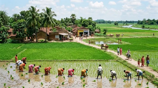
- South Asia – Himalayas, Ganges‑Brahmaputra delta, monsoon climate, Indo‑Gangetic Plain, megacities (Delhi, Mumbai, Dhaka, Karachi), Green Revolution, caste geography
- East Asia – China (coastal vs. interior, Tibetan Plateau, Gobi Desert, Yangtze River), Japan (Pacific Belt, Kanto Plain), Korean Peninsula (DMZ), Taiwan, Yellow Sea
- Southeast Asia – Mekong River, Malay Archipelago (Sunda, Wallacea), volcanic islands (Ring of Fire), rice terraces (Ifugao), Mekong Delta, ASEAN, deforestation (palm oil)
- Oceania & Australia – Outback, Great Dividing Range, Murray‑Darling basin, Great Barrier Reef, Pacific islands (Melanesia, Micronesia, Polynesia), sea‑level rise vulnerability (Tuvalu, Kiribati)
- Polar regions – Arctic (tundra, sea ice, permafrost, Northwest Passage, indigenous peoples – Inuit, Sámi), Antarctica (ice sheet, dry valleys, research stations, Antarctic Treaty System)
23. Regional Geography Concepts
- Formal region – Uniform characteristics (climate zone, language region)
- Functional region – Nodal, organized around a center (city and its commuting zone, newspaper circulation)
- Vernacular (perceptual) region – Popular perception (the South, the Midwest, the Balkans)
- Regional boundaries – Transition zones (ecotones), frontiers, borderlands
Volume 6: Applied & Contemporary Geography (up to 2026)
24. Environmental Geography & Sustainability
- Human‑environment interaction – Environmental determinism vs. possibilism vs. cultural ecology
- Land use / land cover change (LULCC) – Deforestation (Amazon, Borneo, Congo Basin), agricultural expansion, urbanization
- Climate change geography – Sea‑level rise (coastal flooding, migration), extreme events (storms, droughts, wildfires), climate refugees, mitigation (renewable energy siting), adaptation (flood defenses, drought‑resistant crops)
- Conservation geography – Protected areas (national parks, UNESCO World Heritage sites, Biosphere Reserves), wildlife corridors, restoration ecology
- Environmental justice – Unequal exposure to pollution (toxic waste, air quality), food deserts, access to green space
- Natural hazards geography – Earthquakes (Pacific Ring of Fire), volcanoes, tsunamis, landslides, floods (levees, floodplain zoning), hurricanes (coastal evacuation), tornadoes (Tornado Alley)
25. Geopolitics & Contemporary Issues (2026)
- Climate geopolitics – Arctic resource competition, climate migration (Sahel, Bangladesh, Pacific islands), water conflicts (Nile, Tigris‑Euphrates, Indus)
- Technological geography – Internet infrastructure (submarine cables, data centers, 5G/6G coverage), digital divide, surveillance geography (CCTV, facial recognition)
- Pandemic geography – COVID‑19 spatial diffusion (2020–2023), travel restrictions, vaccine distribution inequality, long COVID clusters
- Migration crises – Syrian refugees (2011–2026), Venezuelan diaspora, Central American caravans, Rohingya displacement, EU asylum policy (Frontex, Dublin Regulation)
- Urban futures – 100% renewable cities, 15‑minute city (Paris, Barcelona), congestion pricing, affordable housing policies, post‑pandemic remote work effects (office vacancies, suburban revival)
26. Geographic Education & Careers
- GIScience & technology – GIS analyst, remote sensing specialist, cartographer, surveyor
- Environmental management – Conservation scientist, hydrologist, climatologist, soil scientist
- Urban & regional planning – Land use planner, transportation planner, community development
- International development – NGO worker, World Bank specialist, humanitarian logistics
- Academia & research – University professor, research scientist (USGS, NOAA, NASA, ESRI)
- K‑12 geography education – Geographic literacy, National Geographic Society, AP Human Geography, GeoGuessr, GIS in schools
Volume 7: People, Institutions & Prizes
27. Key Geographers (Biographical Entries – Selection)
- Eratosthenes, Ptolemy, Al‑Idrisi, Mercator, Ortelius, Varenius, Humboldt, Ritter, Marsh, Ratzel, Vidal de la Blache, Mackinder, Hartshorne, Sauer (Carl), Hägerstrand (Torsten), Harvey (David), Massey (Doreen), Tuan (Yi‑Fu), Lynch (Kevin), Berry (Brian), Gould (Peter), Johnston (Ron), Gregory (Derek), Soja (Edward), Smith (Neil), Buttimer (Anne), Relph (Edward)
28. Major Geographic Organizations
- International Geographical Union (IGU) – Founded 1922, quadrennial congress
- American Association of Geographers (AAG) (founded 1904 as AAG)
- Royal Geographical Society (RGS‑IBG) (UK, founded 1830)
- National Geographic Society (USA, founded 1888)
- Esri (Environmental Systems Research Institute) – GIS software (ArcGIS)
- USGS (United States Geological Survey) – topographic maps, Landsat
- NASA Earth Science – remote sensing, climate data
- European Space Agency (ESA) – Sentinel satellites
- UNEP, FAO, WMO, IPCC
29. Major Prizes & Awards
- Vautrin Lud Prize (often called “Nobel of Geography”) – since 1991 (recipients: Harvey, Tuan, Soja, Massey, etc.)
- Patron’s Medal (RGS), Founder’s Medal (RGS)
- National Geographic Society Hubbard Medal
- Carl Ritter Medal (IGU)
- AAG Distinguished Scholarship Honors
30. Landmark Publications
- Humboldt – Kosmos (1845–1862)
- Marsh – Man and Nature (1864)
- Mackinder – “The Geographical Pivot of History” (1904)
- Hartshorne – The Nature of Geography (1939)
- Christaller – Central Places in Southern Germany (1933)
- Von Thünen – The Isolated State (1826)
- Harvey – Social Justice and the City (1973), The Condition of Postmodernity (1989)
- Massey – Spatial Divisions of Labour (1984)
- Tuan – Space and Place (1977)
- Sauer – The Morphology of Landscape (1925)
Volume 8: Appendices & Reference
Appendix A: Glossary of 400+ Geographic Terms
- Abyssal plain to Zonal soil (including: alluvium, azimuthal projection, barrio, choropleth, cryosphere, demographic transition, ecotone, fluvial, geoid, hinterland, isopleth, karst, littoral, meander, neotectonics, orogeny, peneplain, quaternary sector, rift valley, savanna, taiga, urbanization, vernal pool, wadi, xenophobia, yardang, zenith angle)
Appendix B: Map Projections Comparison Table (properties, uses, distortion)
Appendix C: GIS Data Formats & Standards (Shapefile, GeoJSON, GeoTIFF, KML, File Geodatabase, GeoPackage, WGS84, UTM, Web Mercator)
Appendix D: Remote Sensing Satellites (Table: sensor, resolution, revisit, launch, applications)
Appendix E: Köppen Climate Classification (Full list of 30+ subtypes with criteria)
Appendix F: Population Data (2026 estimates – top 10 countries, largest megacities)
Appendix G: Geographic Timeline (30,000 BCE – 2026)
Appendix H: Geographic Thought Schools (Environmental determinism, possibilism, regional geography, quantitative revolution, critical geography, feminist geography, postcolonial geography, non‑representational theory)
Appendix I: Open Access Geographic Data Sources
- Natural Earth Data (cultural/physical vectors)
- USGS EarthExplorer (satellite imagery)
- Copernicus Open Access Hub (Sentinel data)
- OpenStreetMap (crowdsourced global vector)
- WorldPop (population grids)
- FAO’s Global Land Cover SHARE
- NASA Earth Observatory (daily images)
- IPCC Data Distribution Centre (climate scenarios)
Appendix J: Geographic Software & Tools (2026)
- Proprietary – ArcGIS Pro, QGIS (open source, free), MapInfo, ERDAS Imagine, ENVI
- Open source – QGIS, GRASS GIS, SAGA GIS, WhiteboxTools, GDAL/OGR, R (sf, raster), Python (GeoPandas, Xarray)
- Web mapping – Leaflet, Mapbox GL JS, OpenLayers, CesiumJS, Deck.gl
- Cloud geospatial – Google Earth Engine (massive remote sensing analysis), Microsoft Planetary Computer, Amazon SageMaker geospatial
Appendix K: Geographic Coordinate Systems (Datums: NAD27, NAD83, WGS84; Projections for each continent)
Appendix L: Careers in Geography (Job titles, salaries, required skills, industry sectors, 2026 outlook)
End Matter
- Subject Index – A‑Z with page references (e.g., “Central Place Theory, 312–315”, “GIS, 450–470”, “Remote sensing, 480–510”)
- About the Editor – Geographer with 25+ years (specialization: GIScience and urban geography)
- Contributors – Physical geographer, human geographer, cartographer, remote sensing scientist, GIS developer
- Acknowledgments – Funding agencies (NSF, NASA, ESRI), peer reviewers, mapping agencies (USGS, Ordnance Survey)
- Disclaimer – Political boundaries shown for educational purposes; not all are internationally recognized.